Tuesday, August 4, 2009

Point Arena Lighthouse


Location: 45500 Lighthouse Road, its about 4 miles north of Point Arena, Mendocino County, California, and 135 miles north of San Francisco, and 31 miles west of Hopland
Directions: From CA-1, head west on LIGHTHOUSE RD. Drive to the end of the road. Its about 2.6 miles from CA-1 turnoff, it is about 5 miles from Point Arena town heading north.

Coordinates WGS-84: (GPS) 38°57′17″N 123°44′26″W38.95472°N 123.74056°W
Year first constructed: 1870
Year first lit: 1908 (current tower)
Automated: 1977
Foundation: Concrete
Construction: Reinforced Concrete
Tower shape: Cylindrical
Markings/Pattern: Currently not painted
Height: 115 feet, 155 feet above sea level
Original lens: First order rotating Fresnel lens mercury floated
Current lens: DCB-224
Range: 25 nmi
Characteristic: Flashing white 15 s. Emergency light of reduced intensity when main light is extinguished.
The Point Arena Light is California Historical Landmark No: 1035.[1]
Admiralty number: G4358
ARLHS number: USA-611
USCG number: 6-0420


It was about 10:00 am When I arrived at Eddies house in San Bruno. The sun was already high in the sky. We quickly packed our supplies for the day into back of my SUV, Eddie’s daughters Catherine, Jamie and Jennifer where excited and brimming over with energy. Next was a quick stop at Starbucks a fill of coffee and we where on our way.

One indication that you are out of the main suburbs of the city is the local cafes of the small towns, the sense of false sophistication and is replaced by good solid humor and personal relationship. One of our first stops was near Petaluma, where we had lunch at a roadside cafe. The café had a rural & bikers feeling to it. We sat outside, under the canopy, sheltered from the warm sun. Our waitress, dressed in a blue checkered blouse, short blue denim shorts, long high heel shoes and her hair rolled up, finished red ruby lipstick, and covered in tattoos, her jovial humor was welcomed as she sported her big ring and tattooed arm. She took our order, helped the children to choose what to eat from the menu and gestured a knockout blow to my brother Eddie as he joked with her. After lunch, it was a few pictures of the neighborhood and on our way to Point Arena.


Soon, we where in wide open countryside, luscious fields and lots of black and white Holstein cows grazing on the green clover laden fields. These are Californian cows, happy cows. Our view was filled with lovely blue sky, birds and butterflies. As we drove further and deeper into the countryside our remembrance of the city started to fade from memory and nature became our reality, we made a few stops along the way to take in and observe the breathtaking views. We definitely had hit the heartland of Dairy Farms in Marin, I was expecting at some bend to meet a group of Moosicians with their accordions, trumpets and drums.

This was to be a long journey which brought us past Bodega Bay and up the coast road towards Fort Bragg and Mendocino County. At times the road narrowed into one lane and reminded me of the roads in Ireland. A few unusual sights we saw on our way. Cows standing on the sides of cliffs as if they where goats, rising above the clouds and seeing them as if you where in an aircraft, and a monument of American flags, and a immaculate Ford T sitting on the edge of a cliff with no-one in sight. Sometimes I kick myself because I don’t stop and take these pictures. And lots of small towns begging me to get out and take some pictures. The sad thing about my blog is I only post 10 to 14 pictures and if the lighthouse is really interesting then the pictures are all about the lighthouse. I am still thinking about a back roads blog.


It was late in the afternoon when we arrived at Point Arena; we had maybe 30-45 minutes before lighthouse station closed. It’s open between 10am - 3:30 pm each day. I was impressed at viewing this tall erect round tower as it rose into the blustery sky. I could feel its impact it had on the mariners of its day as it protected them from the treacherous waters. It was cold, windy and foggy, the wind cut right through my clothing, as I hurriedly put on my wind breaker. We made our way to fog house building at the light station, where we where greeted by a very friendly black lady in her mid years and her young assistant who was working for the summer while she was off school. There is a very well stocked gift shop in the converted Fog signal building, this is the building from 1896, so we picked up a few ornaments; the proceeds go to the preservation of the lighthouse.


On Display is an enormous 1st order Fresnel lens. Its in beautiful condition, a continuous video is playing on lighthouses, and you are surrounded by visual history of the Arena lighthouse. What is a shame, the Lens had to be removed from the lantern room of the lighthouse because some brain dead woman scratched her initials on one of the prisms, she ruined it for everyone. The Fog signal building is a light station museum and gift shop, lots of photos and artifacts from the past. Eddies Children and I made our way to the top of Lighthouse tower, Eddie was not willing to climb the stairs because of his injured back. The climb to the top is very steep. When I arrived at top I was out of breath, partly due to dragging all my camera equipment and my bum knee. The view from the top was worth it. The Tower is a great observation point to view the coast and the surrounding countryside. I Looked through the telescope and observed some seals on the rocks below. Apparently they are two types here at Point Arena I am not sure what types of seals they are, I will have to find out at a later stage. Went outside on the tower balcony and felt the force of the blustery wind, secured my hat and cameras to my body, certainly my cheeks where going to have a full glow after this.


Inside the tower, they are many opportunities to photograph, the spiraling stairs from the original tower, the lantern room, and the corridor between the walls. After we slowly made our way to the bottom of the tower, we captured a few family pictures to add to our collection. In the dull grey weather with high cold winds, there was a wedding party taking pictures of the bride and groom at the lighthouse. I snapped a few of the wedding party; especially the white stretch limo juxtaposed to the round tower of the lighthouse. We where the last to leave the light station, and we made our way into point Arena town. I find it exhilarating just to watch young people amuse themselves by turning a small town into a plaything. Catherine and Jennifer had fun with the old cinema and the quaintness of town Mural. We spent a small amount of time strolling about an empty town before heading back towards Bodega Bay, where we decided to dine.


As we travelled on our return journey, we stopped at a monument of American flags.It was quite strange, here in the middle of no where a massive fallen tree was decorated with numerous American flags, also it was protected by a light sensor. We spent some time scrambling around the woods in the area. Again Eddie’s children made free with their environment. I must say they are a pleasure to be around, and are respectful to our natural resources. As we continued our journey, we where amazed at the cows standing on the side of steep hills as if they where mountain goats, and the green model T on edge of a cliff. At times it felt as if I was in a surreal world, on mountains above the clouds, cows on the edge of the world and green model T in space, usually after such an experience I kick myself in the pants for not spending more time taking pictures.

Eventually we arrived in Bodega Bay, we had a quick bite to eat, clam chowder, spent a little time perusing the store, wandered to the deck. We had a wonderful sunset, and a great view of the bay, spent a few moments just drinking in the beauty, when we capped it off with Jamie getting some pictures with a Seal in the background. Dusk fell and it was just a long drive home. Darkness has its own way of bringing an adventure to its close, and preparing for the next lighthouse.


History
1543, Spaniard Bartolomé Ferrelo was the first European to name Point Arena, he called it Cabo de Fortunas (“cape of fortunes"). The point is a narrow sandbar peninsula jutting 1/2 mil into the Pacific Ocean. This sandbar creates a natural hazard to seafaring vessels due to its currents and reefs.
1775, lieutenant Juan Francisco de la Bodega y Quadra (commander of the schooner Sonora) renamed the cape to Punta Delgado (narrow point) ,he was part of a royal expedition chartered by the government of Mexico to chart the north coast of Alta California. Later known as Punta Barro de Arena (Sandbar Point)
1850s and 1860s, The Gold rush caused an increase in ship traffic carrying redwood lumber, goods to and from Northern California to San Francisco; this showed the need for a navigation aid at this dangerous point.
1865 November, 10 ships sank in stormy seas just off Point Arena.
1866, The US Government surveyed Point Arena to construct a lighthouse station.
1867. Supplies for the lighthouse station were transported to the Arena Cove and hauled by mule 4 miles overland to the lighthouse site. Local rock was deemed inadequate for the lighthouse, so a local company was contracted to produce bricks on-site. 3 kilns were built, and more than 500,000 bricks supplied.
1869, Lighthouse construction began on what is Now known as Point Arena (sand point), which is part of the Emerald Triangle. The 100 ft brick-and-mortar (masonry) tower included ornate iron balcony supports and a large 2 ½ story Keeper’s residence at its base with enough space to house 4 families, another 114,000 bricks from San Francisco where used to construct the outside of the tower. 1st order fixed; Fresnel lens was installed in the lantern room. There was little quite or privacy with 4 families under one roof. A log entry from 1880 records "Threatening weather and fighting children."

1870, Point Arena was the 1st of 3 tall coastal beacons on the west coast of California, Pigeon Point and Piedras Blancas where the other 2. On May 1st its beacon lit the skies of Mendocino Coast and joined the other sentinels on California’s coast, in sending its warning signals to mariners of the dangerous reefs embedded on in the Pacific Ocean just off its narrow point. The original oil lamp could be seen up to 18 miles away.
1871 A fog signal building consisting of 2 12-inch steam whistles began operation and its boilers consumed about 100 tons of wood in a foggy year, The whistles made a 5 second blast every 25 seconds..
1880's. the point was connected to the local country road (now Highway 1) by means of a government right of way.
1880 June 7, The light keepers log recorded an earthquake shook the Tower , the quake was on the San Andreas fault lying just offshore from the point.

1883, the Lighthouse Board said in its Annual Report the light station was "located on a projecting point, the outer face of which is on an almost perpendicular bluff, made peculiarly dangerous by the liability of sudden caving near the edge of the earth overlying the sand-rock. One of the laborers fell over this bluff and was drowned. A picket-fence 1,400 ft long was built around the structures to prevent further accident."
1888, the light keepers log recorded, Earthquake shook the lighthouse tower
1896 The wearing down of the fog signal building due to its environment had to be replaced by a new construction; its whistle distinctiveness was retained. This fog signal building is now the current Museum which houses the 1st order Fresnel lens.
1898, The light keepers log recorded, Earthquake shook the lighthouse tower
1906, April 18th, a devastating earthquake struck the Light Station. The Lighthouse and the Light keeper’s quarters were damaged beyond repair that they had to be demolished. Only the fog signal building managed to survive the quake. Much of the material from the demolished light station was used for the rebuilding of the new light station. The Light keeper recorded the quake. “A heavy blow struck the tower from the south. The blow came quick and heavy, accompanied by a heavy report. The tower quivered for a few seconds, went far over to the north, came back, and then swung north again, repeating this several times. Immediately after came rapid and violent vibrations, rending the tower apart, the sections grinding and grating upon each other; while the lenses, reflectors, etc., in the lantern were shaken from their settings and fell in a shower upon the iron floor.” The docent on duty said the tower swayed 4 ft in either direction before the lens came crashing down on the turret above.
When workers arrived, temporary housing was built for the keepers and the construction workers. A 30-foot wooden light tower with the lantern room from the original tower was built next to the lighthouse, and a 2nd order lens installed.

1907 January 5th, the temporary began operation.
Cognizant of what havoc earthquakes can wreck on buildings made of brick, the United States Lighthouse Service sought a quake-proof building, they contracted with San Francisco's Concrete Chimney Corporation - to rebuild the lighthouse on the site, their specialty was building Industrial chimneys, which accounts for the unique design for the new Point Arena Lighthouse; featuring steel reinforcement rods encased in concrete. This was the first lighthouse built this way.
On the site of the original tower, the new 115-ft tower was built, It was made of reinforced concrete - an innovation at the time. Iron bars were woven together, surrounded by wooden frames, and then covered by concrete to create the tower. As the tower grew, so did the wooden scaffolding encircling it. Contained in the scaffolding was a mule-powered elevator used to raise the numerous wheelbarrows of concrete to be poured into the forms. After the tower was completed, a doughnut-shaped buttress was built around the base of the tower to give it additional support and create a circular workroom.

The staircase from the original lighthouse survived intact, and was reassembled in the new tower. The tower was supported by a massive base to provide further support and featured a 1st Order Fresnel Lens, over six feet in diameter and weighing more than six tons. Four single family homes were built in row to replace the light keeper's dwelling. The extra space was to provide more privacy to the families of the keeper and his assistants
1908 September 15th 6:00 pm, the beacons of light from a new 1st order Fresnel lens manufactured by Barbier, Benard & Turenne in France, beamed out to sea from its new 115ft tower. The lens was made up of 666 hand-ground glass prisms all focused toward 3 sets of double bull’s-eyes. It was these bull’s-eyes that gave the Point Arena Lighthouse its unique "light signature" of double flashes every six seconds as it rotated atop 3 gallons of mercury. The lens was set in solid brass framework , the wickies had to hand crank a 160 lb clockwork weight suspended in the center shaft of the tower up every 75 mins,the lens was rotated by this action of the clockwork mechanism, caused the rotation to revolve every 18 second. Light was produced by a "Funks" hydraulic oil lamp, that needed to be refueled every 4 hours, and whose wicks would have to be trimmed regularly, it was visible for 20 miles
This incredible optic, that held an appraised value of over $3.5 million,
Prior to the introduction of electricity,.. Later, two 1,000 watt electric lamps were installed to replace the oil lamp, and a 1/8 horsepower electric motor was installed to replace the clockworks.
1937-52 Light Keeper Bill Owens served at Point Arena for 15 years during which time control of lighthouses passed from he Lighthouse Board to the Coast Guard
Owens found the lintel from the doorway of the original tower in the surf, which is now near the tower,

1939. The daymark of the tower was slightly changed as part of this transition, the gallery around the lantern room was formerly painted black, but the Coast Guard decided to paint the entire cement portion of the tower white.
During the war, guardsmen were assigned to patrol the area. Light Keepers where required to report any sightings of enemy ships or submarines. During one of Keeper William Owens watches, he spotted a submarine near the point. When he reported it he was told no enemy submarines where in the area. A lumber schooner Ameilia was sunk near Fort Bragg the next day. Later the US Navy confirmed a enemy sub off the California Coast.
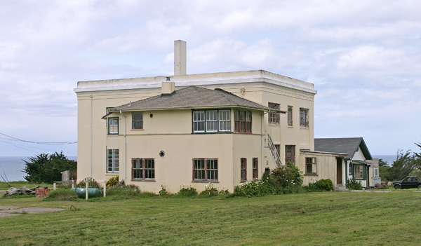
1960, The light keepers' dwellings were demolished and new quarters built. 4 coastguardsmen and their families manned the light station and they occupied the: a 4 bedroom, and 3 x 3-bedroom residences. Other buildings at the time include a paint locker, fuel locker, bosun locker, fire pump, water pumps and JP-5 fueling pumps. A ½-ton truck was used to bring the children to school in the nearby town.
1976, the fog signal was discontinued,

1977 June, An aero beacon was installed outside the tower, and the light was automated. 1st Order Fresnel Lens was discontinued, but remained in the tower. At the time, the lens was the only Mercury-floated light still in existence in the Twelfth United States Coast Guard District..
The 400 pound aircraft beacon had been replaced by a 40 pound modern rotating light that incorporates the Fresnel principles for the efficient projection of light.
There is a battery-powered emergency system installed as a back-up in the event of a power failure. In addition, a radio beacon, with a 50-mile signal that originates from the station, also assists mariners. the current modern rotating light can be seen for 16 miles
The station was closed to the public
1978, the original fog signal at the station was silenced, and a bell buoy was placed nearby.
1982, Point Arena Lighthouse Keeper's, Inc. received permission to conduct tours of the station..
1984, a nonprofit group called the Point Arena Lighthouse Keepers received the light station as part of a 25 year land lease to mange the light station from the Coast Guard and the Department of Transportation.
1992, the film "Forever Young" was filmed at Point Arena. The film stars Mel Gibson, Jamie Lee Curtis and George Wendt. A shell of a Victorian mansion and a gazebo were built on the grounds north of the lighthouse. After eight days of filming, the crews dismantled the Victorian and left as quickly as they arrived. Today, only the gazebo stands along the northern cliffs of Point Arena.
2000 November, the nonprofit group was given ownership of the light station due to their historic preservation and educational efforts. A lot of the group’s income came from lighthouse visitation, museum store sales, lighthouse memberships and rental of the light keeper's homes. This income is used for ongoing preservation of the tower, facilities, and educational endeavors.


2004, the mercury (used to float the Fresnel lens) was finally removed. Over three gallons of mercury was removed. The mercury was no longer needed, and represented a health hazard.
2005, Fresnel lens stabilization work began as the white letharge (special Fresnel lens putty for holding the prisms) was deteriorating.
2006, the lighthouse was the subject of another film - this time a documentary. The independent film includes a description of Fresnel lenses, a history of the light, and an interview with the Owens sisters - daughters of Keeper William Owens.
Point Arena Lighthouse Keepers was awarded $200,000 from The State of California to help with their restoration efforts.
2008, $1.6 million was spent to renovate the public restrooms, fog signal building, and the tower, whose concrete had begun to crumble, the lantern room received a new copper roof and the 1st order Fresnel lens was moved, along with its pedestal and clockwork drive mechanism, to the fog signal building (museum). Jim Woodward a Fresnel lens expert was brought in to oversee the move.
2009 February, the tower was once again opened to the public; it is unpainted. The lantern room has been fitted with a metal floor, and makes for a great observation room with 360 degree view of the area.
Restoration work at the station is ongoing - much of the work done by volunteers and renovation funds greatly appreciated.

Much of the history came from many sources and I am not sure if I have referenced all.

References
Point Arena, Gregory W. Coan, The Keeper's Log, Spring 1993.
Lighthouses of the Pacific, Jim Gibbs, 1986.
Annual Report of the Light House Board, various years.
Umbrella Guide to California Lighthouses, Nelson pp. 143-145
California Lighthouses, Roberts and Jones pp. 22-23
The Keeper's Log Winter 2005, Fall 2005, Winter 2006, Summer 2006
Lighthouse Digest, August 2005, August 2006


Links
US Coast Guard Historical Light Station information & photographs
Point Arena Lighthouse
National Park Service Point Arena

Content is copyright by Ocairdestudio 2009

Cape Mendocino Light


Location: off Shelter Cove near Point Delgado,Humbolt County, California.
Directions: Cape Mendocino’s Lighthouse tower can be seen in the coastal community of Shelter Cove, 24 miles west of Garberville. Take the Redwood Drive exit from Highway 101 and look for road signs to Shelter Cove, the King Range National Conservation area, Redway or Briceland. In Redway turn west onto Briceland Road to Shelter Cove Road. Follow Shelter Cove road to Upper Pacific, it’s a tee junction. Turn left onto Upper Pacific, then make a right onto Machi Road. You will see the lighthouse from the road. The journey is very rugged and isolated. Set aside about a 90 mins to 2 hours for the journey from Garberville and back again. The lighthouse is open to public, when I visited on the Sunday it closed around 4:00 pm. I read that if you call (707) 986-1611 you can your lighthouse passport signed if no one is at the lighthouse.

Year first lit: 1868
Automated: 1951
Deactivated: 1970s (Old)
Foundation: Concrete
Construction: Cast Iron
Tower shape: white 16-sided Pyramidal
Original lens: 1st order Fresnel lens (Ferndale)
Characteristic: white flash every 30 s.
ARLHS number: USA-129H
USCG number: 6-0515
Markings/Pattern: White
Relationship to Other Structure: Separate


This part of the journey commenced on Sunday after my return trip to the Table Bluff lighthouse. It was also my part of my long drive home. I was somewhat satisfied and also dissatisfied with crop of pictures I took. Knowing I had not got the best of shots and yet with the weather conditions as grey as they where, I accepted the limitations of my environment. My mind had reached a peaceful state, not encroached upon by the pressures of the world. I wondered if I could have lived the life of a monk. I felt I could live without people, how sad is that, Barbara Streisand had a song that had a line “People who need people are the luckiest people in the world”. Strange thoughts when you are alone with yourself, almost as if you where high on drugs. All this natural beauty was so intoxicating, I could feel myself being overwhelmed. At times I just had to pull to the side of the road and snap a few pictures. This Gods country and I have no doubt about it.


Cape Mendocino Lighthouse was relocated to Shelter Cove, a small community on the California coast. Garberville is probably the closest town of descent population size; it was a fair journey from Eureka. I drove South 101 to Garberville. Saw the last of the old town in Eureka in my rear view mirror, worth the visit just for the quaintness of small towns. Played my iPod and listened to a wide variety of music as I travelled south. I argued with myself about visiting Punta Gorda, but with a troubling knee and being on my own, reason won out and it was unto Cape Mendocino. The big trees and the vastness of the mountains constantly assailed my vision, to my left, my right, in front and behind, I was buried in green, my favorite color and lost in nature. I felt I was in Gods hand, and He was loving on me. I took the Garberville exit to which is the turn to the ocean and Shelter Cove from 101 and headed towards Briceland. I made a small stop on the edge of Garberville, pulled out my netbook, posted on twitter & Facebook, sent an email or two, had a cup of coffee and continued my journey.


Small Towns are wonderful and picturesque, artistic building from the past, main streets well defined and locked in an endless time zone. Could I live up here, not sure, definitely need to spend more time travelling these back roads. It could be the beginning of a new adventure. What I am now aware of people in the suburbs lock themselves in their homes and don’t venture out. This is like living in a luxury prison. Big Stores, fine dining and even appreciating the finer things of life is not where fulfillment is at. I know when I came back from this expedition I had a tough time adjusting, my heart longs to travel here again.


The Avenue of the Giant Redwood trees, Sinkyone Wilderness State Park, every turn in the road, the road narrowed, and the trees grew larger and larger, at times the sky was blocked from view. Every so often, my eye would catch a glimpse of some animal; I was never sure what it was. After Briceland I came to a junction that put me on the road towards Shelter Cove. I was no sooner on this road when I crossed a small bridge and came to a clearing that was breath taking. I pulled my SUV into the clearing and grabbed my camera and started to take some shots. God was painting in light before my eyes, and my camera could not catch the range of light. After 20 mins I got in my SUV to resume my journey. It took me about 90 minutes driving on these mountainous roads with uncertainty and 45 minutes on my return.


Eventually I arrived at Shelter Cove, I was famished. It looked so tranquil and had the feeling of being in a resort town of Ireland, Ballybunion or KilKee. The people looked so laid back as if they where separated from this mad world and did not care if it existed outside of their community. The lighthouse is located near the southern end of the cove and is clearly visible from the road. I drove straight to the parking lot in front of the lighthouse. Sitting outside the entrance to the lighthouse was 2 ladies, manning their chairs while sunbathing and chatting about the local events. It was around 3:00 pm and I was informed if I wanted something to eat I better do it now, a younger woman, a daughter of one of the ladies worked in the café, just a stone throw from the lighthouse, introduced herself and said she was on her way back to the café. I followed her and ordered myself a cup of coffee and fish and chips. I said outside in the glaring sunlight, with a small breeze, watching a lazy old dog sleeping under a table. The fish and chips tasted great, it was probably the best fish and chips I ever had.


After I finished eating I made my way around the harbor, watching the boats coming in and the people cleaning their catch for the day. I made my way back to lighthouse, spoke to the two female docents and they gave the rundown on the lighthouse and how it wound up in shelter cove. They also informed me that during the winter they get cutoff from the outside world, and even with an SUV you cannot get in or out, and at times you are without electricity and communication. One of the ladies informed me that her husband was from the west of Ireland and had immigrated to United States, and how they retired to this cove. Its amazing what people is willing to share and how friendly they are. I must record some of these conversations and start taking names. She was very interested in my lighthouse blogs and who knows she might be reading this. But I did envy her way of life that day in the cove. Beach front property, green rolling hills, warm blue waters, a gentle breeze and as she basked in the hot sun, what a day to relax. I took my pictures and with a melancholy heart made my way back to Garberville and the long journey home. My weekend trip had ended, but I will be back, planning my next trip in October.

You can not help but enjoy the fabulous 360 degree panorama of, fir trees, deer, mountains, beaches and surf. Not to mention the Pacific Ocean. The area is an eco-tourists dream.

History

Mid 1800’s Navigating the Californian Coast was quite treacherous. At the westernmost point on California coastline lays Cape Mendocino, it is considered to be one of the most deadly areas for ships. It was evident that a lighthouse was needed to guide merchant ships up and down the hazardous coast.

1867, Sept 14th, the Shubrick a lighthouse tender was heading north with building materials for Cape Mendocino when it was shipwrecked near Punta Gorda, 30 miles to the South. The captain ran her a ground saving lives but loosing supplies. A few months later the building materials and men where successfully delivered and had to be hauled up a steep slope to the site where the lighthouse was to be constructed.


1868 The Cape Mendocino Lighthouse Station was quite large, comprising 171 acres. a 2 story brick light keepers house, a barn, and a carpenter’s shop where completed at the site. At a height of 422 feet above the sea, and 200 yards down a steep cliff, level plateaus had to be carved out to provide a site for a concrete slab to hold the light tower. The tower panels was constructed in San Francisco by Joseph Bein, 16 iron panels where put together and bolted to a concrete pad at the platform in Cape Mendocino, The 43ft tower with its double balcony (design was like Point Reyes) was one of the highest lighthouses in the United States. It was the highest after the light at Point Loma was moved. The roof of the tower is rounded like an umbrella, The first-order Fresnel lens, which had been sent to Eureka by sea was loaded on wagons and moved overland 40 miles south to avoid the risk of damage to it by landing at the risky cape.


1868,Dec 1, the 1st order Fresnel lens cast its proud beacon 25 miles out to sea, sending out its beam of light, one white flash every 30 seconds, a new sentinel was born.

1870 earthquake brought down the first dwellings and over the next 40 yrs they had to be rebuilt several times due to earthquakes in the area. Battered by winds which often blew down chimneys and broke windows and shaken by earthquakes made life as a lighthouse keeper extremely difficult. Keepers and their families occasionally stayed in the tower or the oil house when their dwellings were damaged by storms. Sleeping quarters were built near the tower so that keepers could remain in the tower if weather conditions were too dangerous to return to their regular quarters, as the winds where strong enough to easily blow a person off the cliff. Due to the nature of steep cliffs enclosing the station, frequent landslides occurred during the wet season. Dwelling floors warped and ceilings cracked. It took 3 light keepers to maintain the lighthouse station.


1873 an earthquake opened the ground just 15 ft from the lighthouse tower. The light keepers repaired the opened crack with concrete.

1881, Inspector Charles McDougal boarded a boat to be rowed ashore from the tender Manzanita; large waves overturned the boat, throwing McDougal and 3 others into the chaotic waters. They drowned, including McDougal, who was allegedly weighed down by a bag of gold coins fixed firmly to his waist that was to be given as payment to the light keepers. The following year, McDougal’s widow was selected as light keeper of Mare Island Lighthouse near Vallejo, a position she would keep for the next 35 years.

1890's Progress eventually caught up to the Cape Mendocino station, a dirt road was built to the station.

1896, the Lighthouse Board said the oil house is "almost uninhabitable on account of its bad and unsanitary conditions”, It was too small to accommodate all of the keepers, an assistant keeper and his family were forced to live in the oil house. It was used as housing for keepers for several more years. During this time inspection reports stated the health of the occupants of the lighthouse station as "poor" or "fair." Due to its remoteness the light station was serviced by lighthouse tender


1905, the Blunt's Reef Lightship was stationed offshore to more clearly mark that deadly hazard.

1906 earthquake did more damage to the Cape Mendocino light station and 2 more buildings had to be added..

1908. The 2 New buildings were built, The head keeper’s house was located 300 ft SE of the lighthouse and 35 ft higher on the cliff. A duplex for the two assistants was built 50 ft farther up the cliff face, on a terrace that was roughly 150 ft north of the head keeper’s house.
Even though most of the land was steep, the bucolic hills did provide good feed, and several keepers grazed cows at the station. Assistant keeper P. Hunter raised ponies on the station for the stage line that ran near the station from Ferndale and Petrolia. Given the rising and falling nature of the landscape near Cape Mendocino, a change of horses needed to be made just 4 miles NE of the station in Capetown. Hunter supplied horses for the stage line until motorized vehicle was introduced. After his side income ceased, he transferred to Punta Gorda to be nearer to his hometown.


1916. The passenger steamer Bear ran aground, the steamer’s lifeboats were used to take people ashore, Due to the hazardous surf, 5 drowned, It was considered safer to head for the lightship. 150 people squeezed aboard the lightship. From there they where safely moved to land.

1926 October, The elevated station proved to be an ideal lookout post for Ships. Light Keeper M. M. Palmer saw the Everett a steam schooner, was on fire. From the Light station’s telephone, Palmer called for help. It was found that the crew of the Everett was overcome by the fumes of the fire’s, when the rescue crew arrived. Palmer was attributed with saving the lives of all aboard the schooner Everett.

1939 The United States Coast Guard took control of the Cape Mendocino Lighthouse when the United States Lighthouse Service merged with it. by which time the new caretakers were able to drive vehicles to their remote residences

1951 The light was automated by the uscg a rotating aerobeacon was placed in the lantern room. and the Fresnel lens (1948 according to uscg) was sent to Ferndale, California at the Humbolt County Fairgrounds it was installed in a replica of the tower, During each night of the fair, the lens is lit and sends forth its sixteen beams of glorious light.

1960, the wooden structures at the site burned to the ground to prevent them from being inhabited by squatters.

1971 The rotating beacon was removed from the tower in and placed on a pole farther up the hill. The Light Tower remained - forlorn and abandoned to vandals and the elements. It appeared to be just a matter of time before the old tower would tumble off the cliff and into the sea.

1998, The abandoned lighthouse was slowly inching down the hillside and gradually succumbing to rust until a movement was initiated to save the tower the Cape Mendocino Lighthouse Preservation Society stepped in and moved the tower to Shelter Cove. 1st week of Nov, the Army National Guard helicopter lifted the lantern room off the tower and moved it 30 miles south to Shelter Cove. The lighthouse tower was dismantled numbered, and trucked to a construction yard for restoration. Shelter Cove, was home to a 3,340-lb fog bell, cast at the Navy Yard on Mare Island 1883, used at Alcatraz Island, Los Angeles Harbor, and Carquinez Strait. The Coast Guard finally donated the bell to Humboldt County Historical Society, who gave it to the College of the Redwoods, near Eureka, where the bell is currently on display


1999, the Cape Mendocino Lighthouse Preservation Society had the lighthouse, restored, painted, and fitted with new glass, The lighthouse tower was reassembled at its new location, Point Delgada, Mel Coombs Park, Shelter Cove.

2000 May, after 2 yrs of restoration, the tower was opened to the public. All that remains at the original site is the tower's foundation and a nearby plaque commemorating the lighthouse..


References
Lighthouses and Lifeboats of the Redwood Coast, Ralph Shanks, 1978.
Lighthouses of the Pacific, Jim Gibbs, 1986.
Umbrella Guide to California Lighthouses (2nd Ed.), Nelson pp. 154-156
California Lighthouses, Roberts and Jones p. 18
America's Lighthouses, Holland pp. 170-171

Trinidad Head Memorial


Located: in Trinidad Harbor, California,15 miles north of Eureka, California.
Directions:Take the Main Street/Westhaven Drive Exit From Highway 101 from Eureka ,head west on Main Street, At the end of the road, Turn left onto Trinity Street and follow it to the end. The memorial lighthouse is at the intersection of Trinity Street and Edwards Street. click here for overview map click here for detail map

Coordinates WGS-84: (GPS) 41°03′06″N 124°09′05″W41.0518°N 124.1514°W
Year first constructed: 1948
Year first lit: 1948
Automated: No
Construction: brick
Tower shape: Square Pyramidal
Height: 25 ft
Original lens: Fourth order Fresnel lens (1898)
Current lens: Fourth order Fresnel lens (1898)
Characteristic: white light occulted every 4 s


I journeyed back towards Crescent City from St George Reef, The weather was a little clearer but still over cast, it was not cooperating with me and my camera, with the sky so dark and grey it was hard to get some sort of descent shot of the St George Reef lighthouse. it means that I will have re visit and
find someway to get closer to the reef. I got a few shots of St George 5 miles out in the foggy water and a few more shots of Battery Point from a different perspective. Drove back into Crescent city and filled my SUV with gas at a Chevron Station. The station gives full service at all of the pumps, including the self service pump. I met this charming old guy, who am I kidding “old guy”, I am 57 with plenty of grey, he cleaned my windows, and pumped my gas for me. In a very short period of time, he filled me in on how life is this far up in the hills. He was quite chatty and very friendly, I was now knowledgeable about the way of life in Crescent City, he took my credit card to pay the cashier and brought me the receipt. It appeared as if every pump had some attendant to assist and clean windows. All of the attendants where engaged with their customers in some topic of conversation, it was a nice break from the isolated life of the city gas stations.


It was getting late in the afternoon day and instead of looking for the museum that housed St George Reef lighthouse artifacts, I plugged Trinidad into my GPS and I was headed towards Eureka. Near the town of
Klamath , I spent a little time taking pictures of a derelict house near the roadway. Some of those pictures are on my Table Bluff blog. I interspersed the experience of the two lighthouses. As I wondered around this derelict building, I got an intense feeling of vulnerability, even out here away from the dangers of a city. I felt so vulnerable, almost to the point of panic. I looked at the walls as they were plastered with graffiti, and felt the effects of nature reclaiming her domain, and thought who would abandon such a property and what kind of people could vandalize the ruin. It looked like the home of junkies. So many of our lighthouses have suffered such an abuse, you have to go out of your way to destroy what you cannot appreciate; I saw the beer cans and the needles of death and garbage scattered about the place, real sad to see in the wild.

I really enjoy the vastness and beauty of mountains and the feeling of isolation and freedom; it is so calm, quiet and beautiful, I could forget the race of city animals and dwell in the beauty of Gods creation. I digress; at each destination I am not sure what to expect, from the environment to the weather, it’s a challenge of expectation. I have printouts from the Internet, I have my history from books, and even a picture or two, but it does not prepare you for the rawness of nature. Constantly my senses are overloaded with Gods beauty and grace. This vastness is given to us without charge, all we have to do is take care of it and not abuse it. Treat it tenderly and it will reward us with beauty. Nature is one of Gods gifts. It is ours to pass on to the next generation and to teach them to look after it for others.


Finally I arrived in Trinidad, Trinidad Head memorial overlooked Trinidad cove/harbor and had some spectacular views of the bay. Picturesque it was, with lots of yachts and boats anchored in the cove. Trinidad is definitely a small town with very friendly people. Not too many people were at this particular site. No park ranger or docent to give a local tidbit of information. Even those who came by knew very little about the lighthouse. I know that there is an active lighthouse in the area and it can be partially seen from some trail. I tried to find it, with no luck.

Later I was to discover that every June there is a festival, in which the Coast Guard opens up the lighthouse to visitors. I spent about 30 minutes taking my pictures.


History

1947 After modern optic and air horn replaced the original fog bell and Fresnel lens at the Trinidad Head Lighthouse, the Coast Guard donated the historic items to the Trinidad Civic Club to be displayed in a memorial park overlooking Trinidad Bay.

1948 Trinidad Civic Club built a replica of the original lighthouse tower in a park; Mrs. Earl Hallmark donated land for the park overlooking the cove. They installed the original fourth order Fresnel lens in the replicas lantern room. They hung the original stations, 1898, 4,000 pound bell from a wooden frame and is on display next to the replica tower. Many believed this replica was the original lighthouse.
1949 the Trinidad Civic Club received the California Grand Sweepstakes Prize in Build a Better Community Contest sponsored by the National Federation of Women's Clubs and the Kroeger Company.

early 1970s, the Trinidad Civic Club decided to establish a memorial at the lighthouse for those lost at sea. The memorial started as a marble slab engraved with sea gulls and the words "Lost At Sea," but has steadily grown through the years,

In 1975, the club created a four-sided, pyramidal, rock-cement monument, located near the fog bell, that supports plaques inscribed with names of those lost at sea. Inscriptions were later added for those who were buried at sea, and the list of names soon outgrew the plaques on the small monument, so additional plaques were placed along the adjacent cement retaining wall. On Memorial Day, people gather to remember those whose names are recorded on the plaques, the fog bell was originally rung at the gatherings. Today the bell has been automated to toll at noon of each day in memory of those lost. here to hear the bell toll .

In August of 1998, new windows and a new stainless steel dome were installed atop the tower thanks to the efforts of community volunteers and Tom Odom, former mayor of Trinidad.
Spring 2003 Keeper's Log, a local branch of the Yutok tribe has sued the town of Trinidad over ownership of 12 acres of land along the bluff, including the memorial lighthouse grounds. They want the memorial light removed.


External links
US Coast Guard Lighthouse webpage.
Lighthouse Friends
Cyber Lights
Rudy Alice Lighthouse
Redwood Info
Internet Public Library

Content is copyright by Ocairdestudio 2009

Table Bluff


Located: The tower portion is now at the Woodley Island Marina in Eureka.
Coordinates WGS-84 (GPS) 40°41′45.02″N 124°16′26.16″W40.6958389°N 124.2739333°W
Year first lit: 1892
Automated: 1953
Deactivated: 1961
Construction: Wood
Tower shape: Square
Height: 35 ft
Original lens: Fourth order Fresnel lens
Current lens: (removed)
ARLHS number: USA-832
Operational? No
Markings/Pattern: White
Height of Focal Plane: 176 ft
Fresnel Lens Disposition: 4th Order Lens on display at Humbolt Maritime Museum
Fog Signal Type: Steam Whistle, Air Siren
Number of Stories: 2
Architectural Style: Victorian
U.S.C.G. District: 11

Directionss: From 101 Highway to 255 North in Eureka. Take the Samoa Bridge to Woodley Island/Marina. Follow Startare Drive to end of the island. The Tower is in the parking lot.

The Fresnal Lens is in The Humboldt Bay Maritime Museum at 77 Cookhouse Lane, near the Samoa Cookhouse in Samoa, For museum information, call (707) 444-9440.

It was getting late in the day, I plugged Table Bluff into my GPS and I was on my way back towards Eureka from Trinity Head. Just outside of the town of Klamath I came across a derelict house near the roadway. I pulled in and spent a little time taking some pictures of the derelict structure, its amazing how fast nature reclaims her domain once man has abandoned it.


Continuing on towards Eureka, I saw a herd of Elk grazing along the side of the highway. I stopped took a few pictures and a small video with my G9. Other motorists where pulling in for their moment of picture taking. For someone who lives in the suburbs such as me this was a wonderful experience. I pulled out unto the road happy that I saw these magnificent animals; they looked so beautiful and graceful with their antlers as they grazed alongside the road. I was no more than 6 ft from the nearest Elk.

I still had more than 40 miles to travel back to Eureka area and evening was quickly approaching. I was heading towards Samoa Island where a museum housed the Lens from Table Bluff Lighthouse. The excitement of this adventure was that I did not know where I was heading or what to expect when I arrived at my destination. This trip was not like my other excursions to lighthouses; I was in another part of the world and it was unfamiliar to me, the people I had met so far were ultra nice. The weather was okay and the roads pretty narrow, but smooth. Sometimes it reminded me of the roads in Ireland.

After a long scenic drive, a diversion or two and some misdirection’s by my GPS, I arrived at the Samoa Cookhouse. I saw the Museum on my left, but it was just closed. I met the curator as he was leaving. He was an elderly gentleman; I could see he was on his way to dinner with a young lady. He was willing to re-open the museum for, but I declined, I said I would drop by on Sunday, he replied it was closed. He went on to tell me how Table Bluff was restored to the Marina, that part of the story is the History section. We where joined by Buffalo Bill, a friend of the curator. I loved his white hair and little goatee that hung from his chin. He looked as he just dismounted from a horse.


We talked for sometime and the evening dusk fell. Buffalo Bill, shared some stories of Punta Gorda, after he explained the difficulty of getting to it, I contemplated to visit it another time. My leg was throbbing, so I thought best to have dinner in the Samoa cookhouse and rest the leg. If you are ever in the area, drop in, it’s worth the visit. While waiting I looked around the cookhouse. It was certainly different from any restaurant I had visited. Long tables with plastic red/white checkered table clothes, Lots of artifacts from the loggers. Saws, drill, cooking utensil, every sort of tool you could imagine, and a selection of pictures from the past. I know my brother Eddie would have loved this place.


It was one price for the meal, no menu. Soup, Salad, two entrees, dessert and coffee all for $14. I did not eat all of it, I was too full. I was sitting at one of those long wooden tables, long enough for 20 people, and it was draped by a red/white checkered tablecloth. I took out my netbook and posted a message, the young waitress was fascinated by the netbook and inquired how I liked it. She then shared some stories, about school and her young son; it’s amazing what people will tell a stranger, I suppose there is something inside that wants to communicate with the outside world. By the time I finished dinner it was dark


I made my way to Marina Island/Woodley Island , Woodley Island is the home of Table Bluff Lighthouse, which was relocated to the island in 1987, also on the island is a memorial statue "The Fisherman," by artist Dick Crane. Both Lighthouse and statue commemorate those who have lost their lives at sea. Once on Woodley Island I followed the road until it came to an end. I saw the Lighthouse, it was a square tower severed from its main keepers building. I got a succinct feeling that this lighthouse was not complete, even though it was located in a sheltered harbor. Missing was the keepers building, any fog signals, and the isolation that usually accompanies a lighthouse, and the ruggedness of the area. The scenery here was quaint, nice and very picturesque, a pleasant looking parking lot overlooking the moored boats in their slips; it appeared as if everyone had drifted into the world of dreams and make belief. The time was approximately 10: pm. This was night photography, so I retrieved my tripod from the SUV, no people around so I took my time in setting up and shooting. After an hour or so, I packed up and looked for a hotel. I found the Best western, a step up from the night before. I took some shots to experiment with HDR process. I wonder can you spot the shot.

It was around 11:00 pm, when I decided I needed a place to rest. I nearly set up camp in my SUV, but I am getting too old for such stupidity. Got a room at the Best Western, not too bad; it had a good feeling about it. Once settled in my room, I had a glass of wine, I reviewed some of the pictures I shot and made plans for tomorrow’s lighthouses. I had to revisit to Table Bluff and take some day time shots, from there to Trinity head, ending the Tour at Cape Mendocino and finally homeward bound.


. I arose around 9:00 am, had a continental breakfast and headed over to the Marina. I am glad that I did some nice views on the Marina during the day and the clouds started to roll back. This was a lot different from yesterday, daylight versus nightlight. At night it was overwhelming tungsten, where as today it’s the blueness of daylight, at least I have the photographs from both shoots. I wish I could spend more time here, but its not practical, I have to work and make some money to do this. But at least I got to spend some daylight hours around Table Bluff, and you know it was tranquil and serene,
lovely area to visit, touristy. I did not spend much time, looking at old town just noticing the renovation, shops and people. I got to the pier and met a fellow photographer; he was waiting for some Pelicans to fly by. I got a few shots of Table Bluff, but not from the angle I wanted. So now it was unto the next Lighthouse Trinity Head Memorial.

History

1850'sthe area became an entry point for miners searching for California gold, the Bay is the largest Harbor in Northern California. It was one of the first eight west coast lighthouses chosen by the Lighthouse board. Lighthouse Board selected a site, near the entrance to the bay; it was on a sandy northern spit where it could be utilized as a coastal and harbor light. The area was prone to flooding and often hidden by fog.


1856, The Humboldt Bay North Spit Lighthouse was completed at the cost of $15,000 the lighthouse was finished and its beacon shone. The Light station was constructed as a single story building with a tower through its center of the roof. This tower was elevated later to improve visibility. A 4th order Fresnel lens was housed in the tower. The Humboldt Bay North Spit Lighthouse had for many years been criticized as being too low
1867, 1867, the lighthouse Board suggested that the lighthouse be moved to the 165ft high Table Bluff, four miles south of the bay’s entrance. From that prominence, the light would be able to serve seafarers entering both Humboldt Bay and Eel River, situated just south of the bluff
1874, A steam whistle was added.
1885, after a few earthquakes, and being flooded by a high tide the Humboldt , and 20ft waves Harbor Lighthouse was deemed uninhabitable
1891, Money was allocated for the new station on Table Bluff. The owner of the wanted $5,000 for about 10 acres of land and retain the right of way for the road to the light station and access to a nearby spring. The Board thought the price was exorbitant and set about condemnation proceedings. The next year, the owner of the land gave in and sold the land for $2,226.
1892, 1892, the Lighthouse Service built a light station on Table Bluff, a headland to the south of Humboldt Bay, which had view of the Humboldt Bay. The station had duplex Victorian keeper’s quarters, a fog-signal building, and assistant keeper’s quarters with a 35 ft square light tower attached. The fixed, 4th Order Fresnel lens was taken from the Humboldt Harbor Light and placed in the light tower (The focal plane of the light was placed at 187 ft and an improved visibility to 20 miles. ), two wash houses, an oil house and a carpenter shop behind the main building. The keeper’s quarters were made of a redwood Italianate-stick Victorian, and the structure was similar to the structure at San Luis Obispo. October 31, 1892, lens the Humboldt Harbor Lighthouse was activated on Table Bluff by keeper Tony Schmoll.
1906, , the Navy established a radio station on the property and during World War II the station was expanded to include lodging for mounted beach patrols, a coastal lookout post, and a radio compass station. During the war and immediately afterwards most of the original buildings were razed along with some of the newer structures. The quarter’s portion of the lighthouse was razed leaving only the tower. This and the fog signal building were all that remained of the original buildings.
1911, the fixed Fresnel lens was replaced with a revolving one. Thus changing the lights attribute from fixed-white to flashing-white.

1922, 1922, Keeper Stephen Pozanac was relocated from Ano Nuevo to Table Bluff with his wife. While he served at Fort Barry in Marin County during WW I he was impressed the keeper’s lifestyle, that he became one at the end of the war.He knew the lighthouse keepers at Point Bonita w While on a ferryboat in San Francisco, Pozanac met his future wife Minie Diflivson, daughter of Peter Diflivson, keeper of Lime Point Lighthouse. Apparently Pozanac was also impressed by the daughters of lighthouses keepers as he asked Minie to be his wife.
The Pozanacs supplemented their keeper’s income by using part of the expansive lighthouse reservation to raise large quantities of chickens and vegetables. Soon, they were not only supplying eggs, fryers and produce for the station, but also for a number of grocery stores in Eureka.
One night, Pozanac was making his way to his post in the fog signal building to stand watch when a strong tremor struck the station. The earthquake toppled the tall chimney on the fog signal building and sent it crashing through the roof. The pile of bricks landed right where Pozanac would have likely been standing watch had he reached the building. The fortunate Pozanac remained at Table Bluff until 1938, when he was transferred to Ballast Point Lighthouse, a twin of the Table Bluff Lighthouse.
1934-48, during World War II, the military used Table Bluff as a coastal lookout and a radio station. A large barracks was built along with six quarters for married men. The Military patrolled on Horseback the coast between the Eel River and Humboldt Bay. After the war ended, only the keepers were left at the station. Their was an excess of housing, and the Coast Guard decided to demolish the Victorian dwelling and the assistant keepers duplex of the lighthouse in favor of the more modern military quarters. The separated square wooden tower had to be stabilized by cables

1953,A modern optic was installed in the tower, and the Fresnel lens was shipped to San Diego to be displayed in the Old Point Loma Light which is a museum operated by the National Park Service, a fixed 3 1/2 order lens installed.. The fog signal was discontinued the same year and the station automated.

1975 1975 the light was discontinued and the property transferred to GSA and sold. The 3 1/2 order lens was shipped to the Smithsonian.

1987, 1987, The lighthouse tower was cut in two and moved to Woodley Island Marina in Eureka, thanks to a local resident named Ray Glavich. The cupola from the original light on the north spit was found at Coast Guard Station Humboldt Bay. It was restored and is now on display with the 4th order Fresnel lens at the Humboldt Bay Museum in Samoa.


References


1. California Lighthouses, Roberts and Jones p. 16.
2. Lighthouses and Lifeboats of the Redwood Coast, Ralph Shanks, 1978.
3. Lighthouses of the Pacific, Jim Gibbs, 1986.
4. The Keeper's Log Spring, Summer 2003.
5. Umbrella Guide to California Lighthouses, Sharlene and Ted Nelson, 1993.

US Coast Guard Lighthouse webpage.

Content is copyright by Ocairdestudio 2009